How does Hivekit compare to Domain Specific Offerings?
There is a wide array of bespoke solutions for everything from fleet management to car-sharing, scooter rental, mining safety, taxi dispatch, law enforcement coordination, geocaching, and every other facet of spatial offering imaginable.
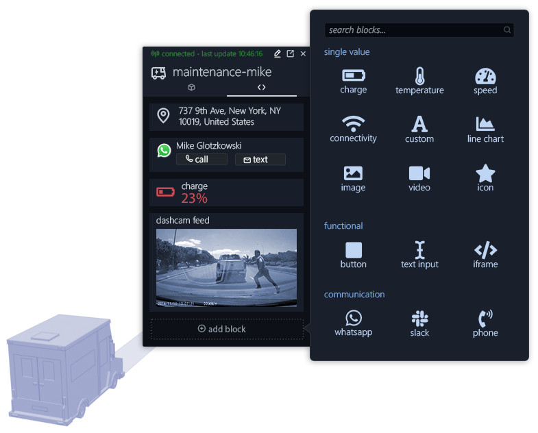
Our goal is not to compete with them - but to enable them. Hivekit provides powerful and scalable low-level infrastructure and core building blocks - making us more akin to an AWS for the spatial world. We specifically provide features such as multi-tenancy, customer-side authentication, and granular permissions that enable our customers to build secure, scalable, and flexible solutions for their end users.
03 · MAPPING PROVIDERSHow does Hivekit compare to mapping providers like Google Maps, Bing Maps, Mapbox, Here, or OpenStreetMap?
Mapping providers give you access to embeddable maps as well as APIs for routing, geocoding (turning a written address into coordinates), reverse geocoding, and some additional features, such as directories of famous landmarks.
Hivekit does none of these things. Instead, we built Hivekit to work on top of Mapping providers. Our user interface uses MapboxGL itself, and we provide demo integrations for Google Maps, Bing Maps, Mapbox, and more.
04 · SPATIAL DATABASESHow does Hivekit compare to spatial database extensions such as PostGIS, H2GIS, or databases with support for spatial data structures such as MongoDB or OrientDB?
The internal core of Hivekit is a proprietary server cluster that stores spatial structures in memory, streams out updates, and processes rules. This server also writes backups of its data to disk. The resulting API might thus look similar from the outside to the functionality that spatial databases offer.
But, Hivekit's focus is on real-time updates, data broadcasting, and rule execution rather than the query-and-response model of spatial databases.
Likewise, Hivekit's query capabilities are oriented toward streaming data (e.g., "give me continuous location updates for all objects in a given area that match a set of criteria."). This focus also means that Hivekit's query capabilities are far less feature-rich than e.g., those provided by PostGIS.
05 · GISHow does Hivekit compare to Geographic Information Systems (GIS) such as ArcGIS, SAGA, NextGIS, or Carto?
GIS is a bit of a fuzzy term. Technically, all systems that process geographic information, including Google Maps or MongoDB, are Geographic Information Systems. Colloquially the term GIS refers to map-building and spatial analytics software such as ArcGIS or Carto.
These systems allow users to import large amounts of data into a map and run sophisticated spatial analytics on them - things like "show me the relationship of crime rates and poverty levels to postcodes" or "overlay traffic data with air-pollution-heatmaps".
Hivekit, by contrast, is focused on providing cloud infrastructure for developers to build geospatial apps. We offer some degree of querying capabilities, but these are entirely focused on realtime data streams to end-user apps, rather than the sophisticated analytics that GIS systems provide.
06 · OPEN SOURCEOpen Source Offerings
There is specifically one open-source project called Tile38, that provides a subset of Hivekit's functionality. And it is pretty awesome - you should check it out.
Hivekit's core server is somewhat comparable - both are written in Go, both process data in memory, both provide subscriptions and geofences etc.
But that's also where the similarities end. Tile38 is meant to run as a single instance within a backend infrastructure to process spatial events. Hivekit's Core server is designed as the backbone of large-scale spatial platforms - both run by us or by our enterprise clients in their datacenters.
Hivekit's server can run in horizontally scalable clusters with multiple layers that perform different tasks (see clustering). It can handle millions of end-user connections via Websocket, HTTP, and TCP. It persists data to disk and provides re-hydration, failover, and intra-cluster routing. It runs instructions in response to spatial events, offers fine-grained permissioning, access control...and much more.
06 · EVERYTHING ELSEHow does Hivekit compare to tools for Landscape Metrics, Landscape Modelling, Atmospheric Correction, Geographic Data Mining, DIP Software, Radar or Lidar reading?
These tools provide other functions for the creation and processing of geospatial data. There is no overlap with Hivekit's functionality.
I hope this helped somewhat to delineate Hivekit within the geospatial space. If you'd like to learn more about how Hivekit compares to a specific offering, please don't hesitate get in touch:


